SystemMining Intelligence · Online UTC--:--:-- EngagementPrivate · Client Confidential
Product 02 Mining Intelligence

Find the asset.
Measure the ground.
Track the build.

Mining intelligence is a sequence: locate candidate ground, inspect the signal, monitor the named asset, model access and terrain, then keep watching as development changes the physical site.

Ghana Gold · Hero Frame Wide-area disturbance · access corridors
Gold mining corridors visible through forest from satellite imagery
Wide-area gold mining disturbance and access corridors visible through satellite imagery.
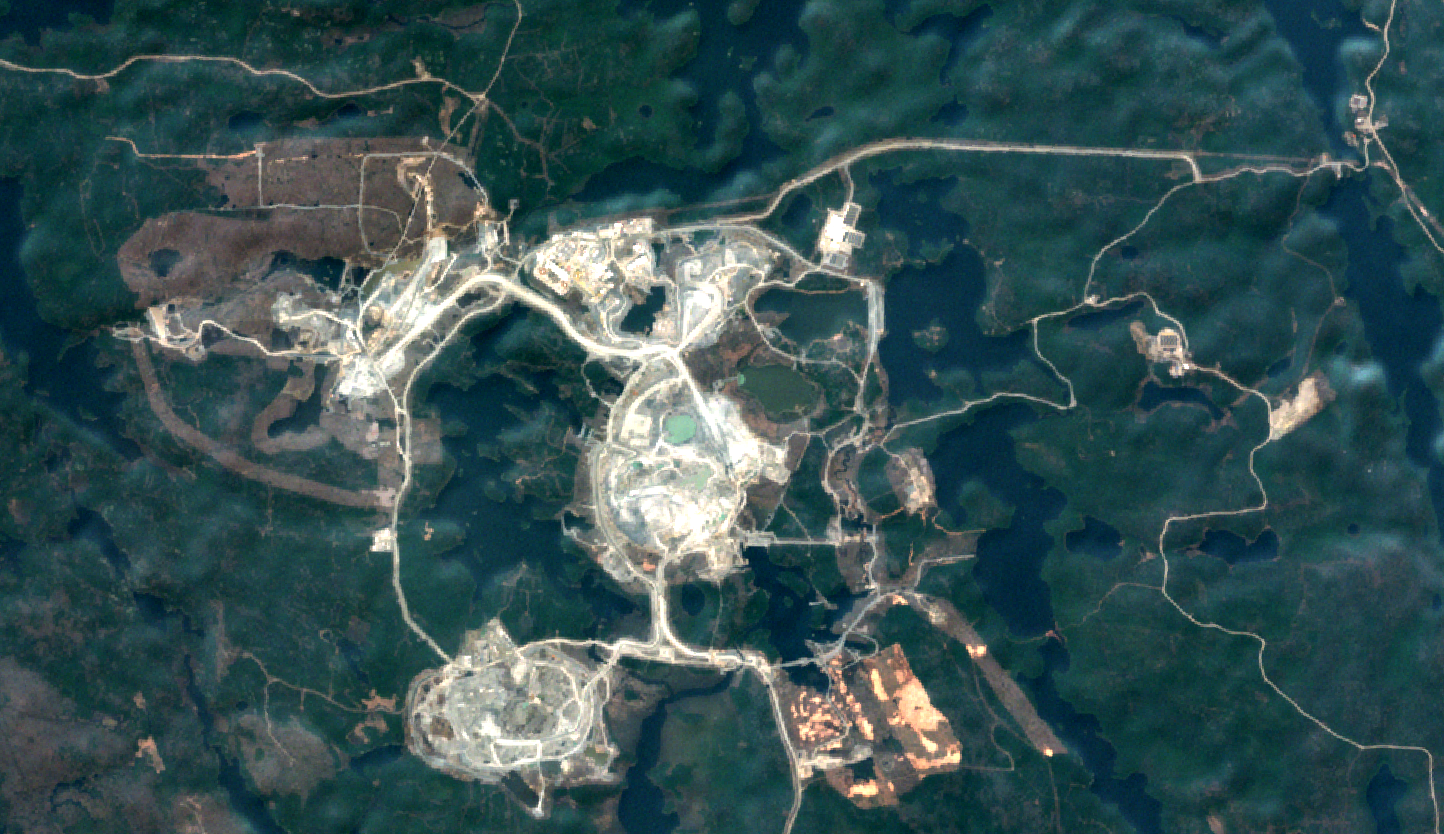
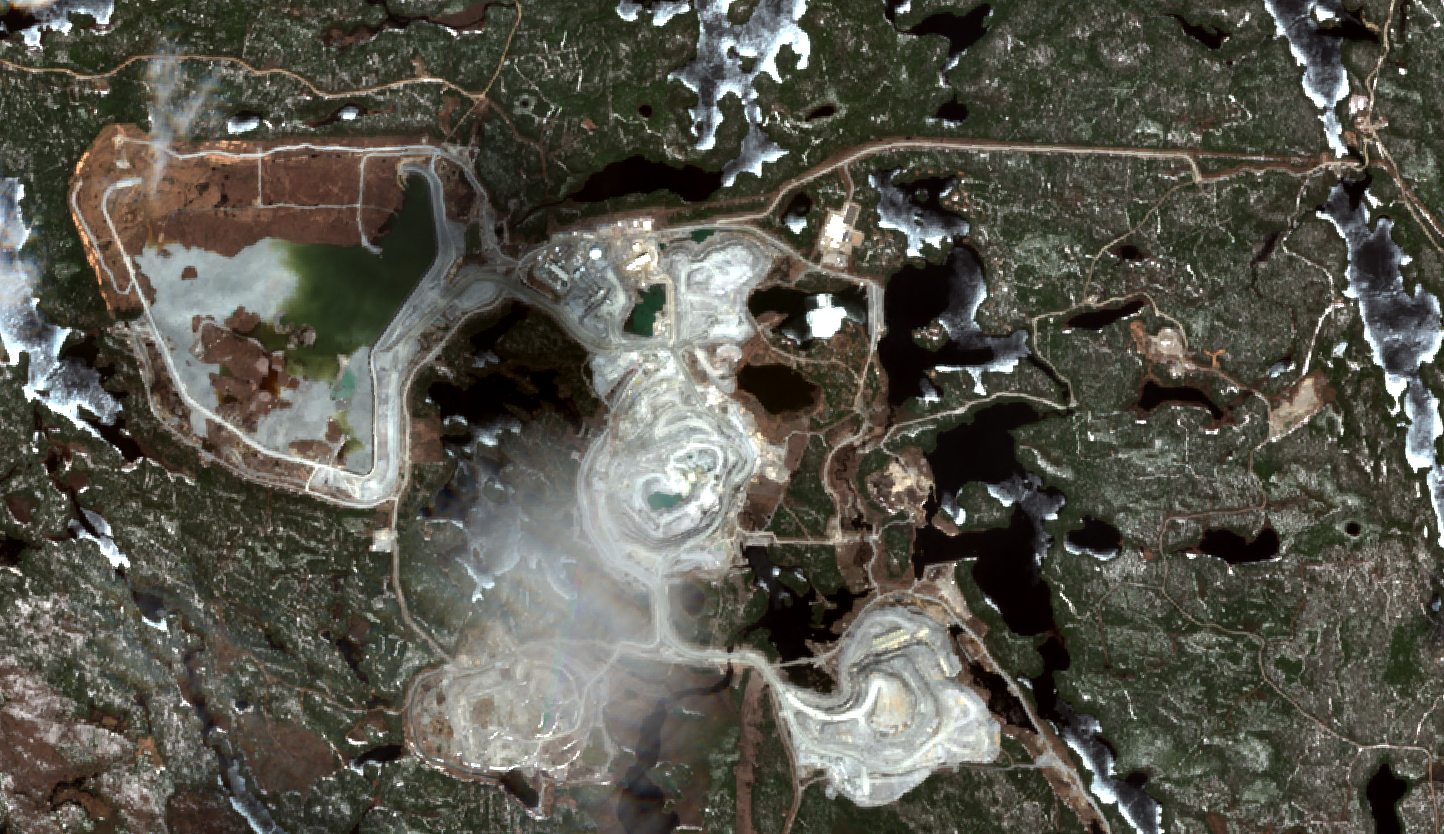
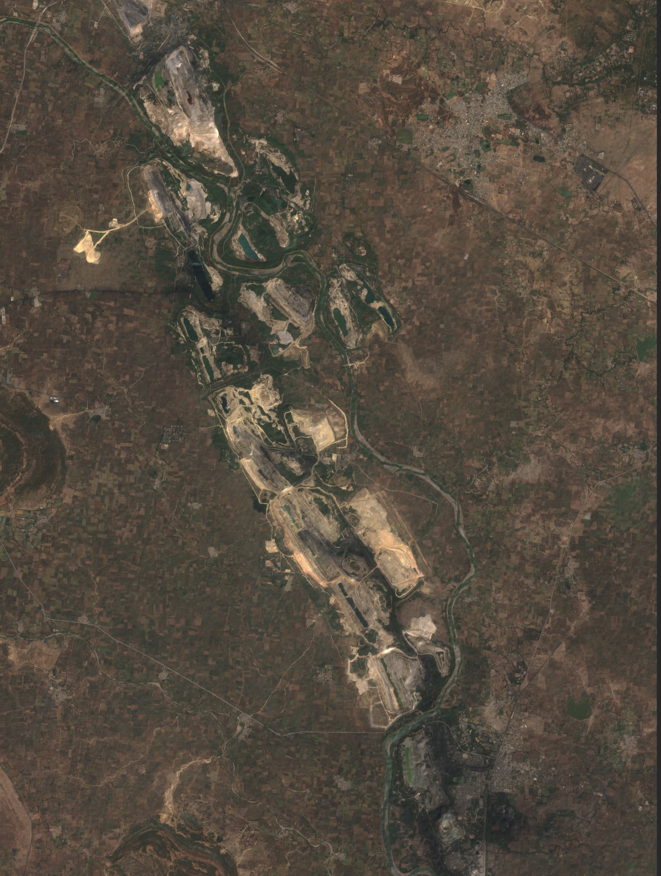
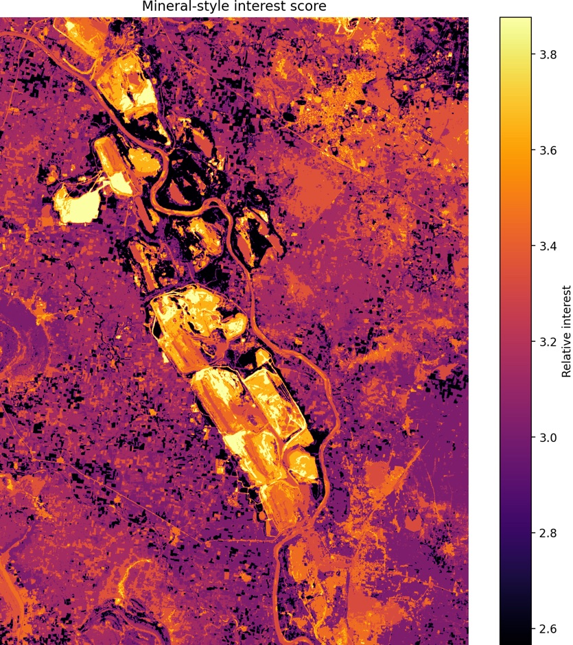
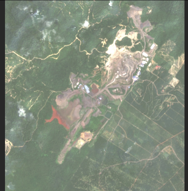
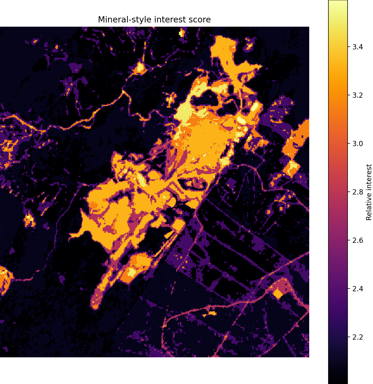
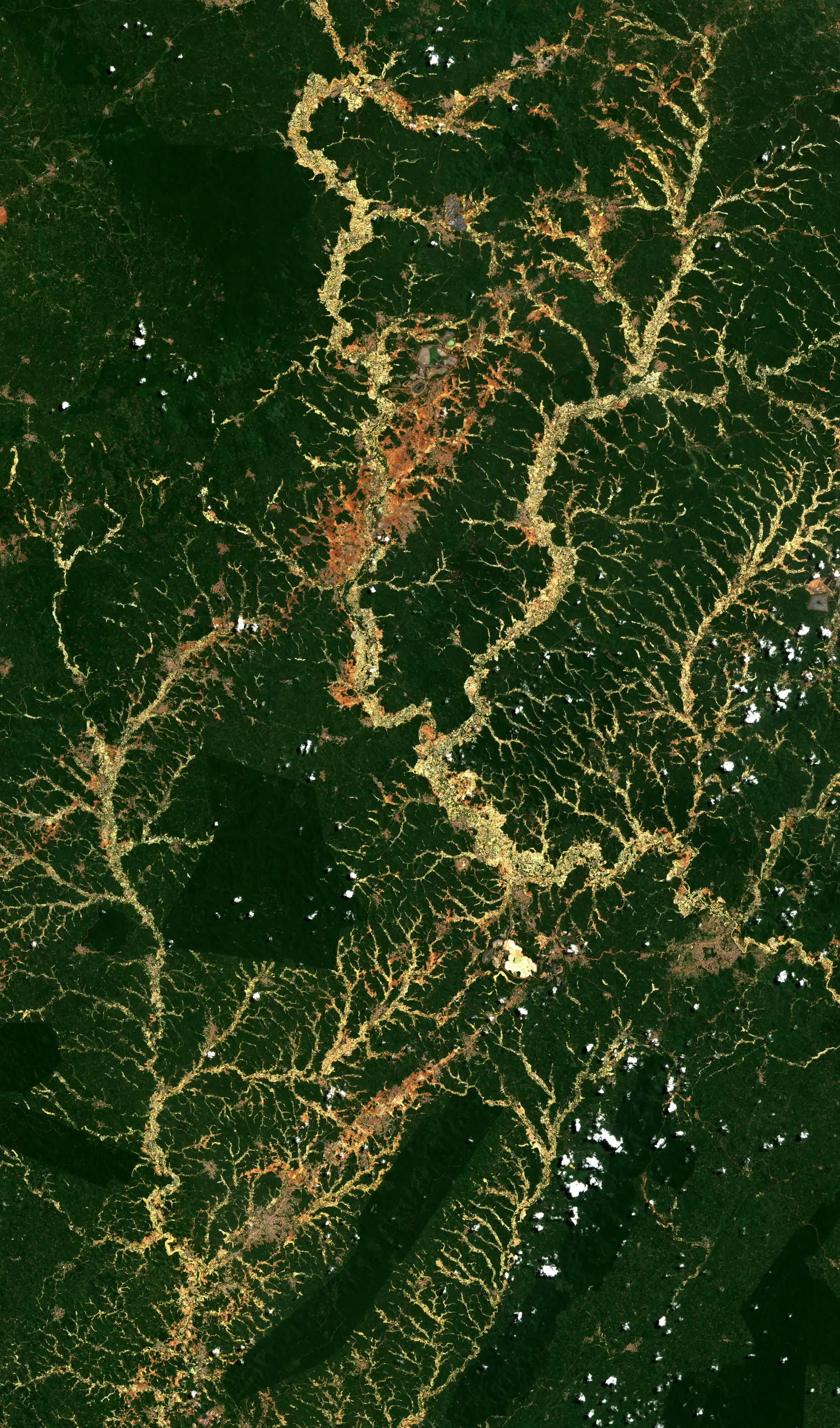
01 / Build the operating picture Mine Command Layer

Fuse geology, known assets and satellite coverage into one mine map.

The system starts by turning scattered mineral data into an operating surface. Known mines, project records, terrain, raster imagery and live views are brought together so the analyst can move from global screening to asset-level inspection without changing context.

  • Known mining sites, project records and proprietary raster coverage.
  • Satellite scene review for active and candidate locations.
  • Live mining market context for deals, project updates and site progression.
Full Mining Suite Mining command layer · platform footage
Mining layers, project data and imagery controls are combined into one operational interface.
02 / Search for under-read ground Prospecting Workflow

Use mineral-style signals to narrow the reconnaissance field.

Reflectance-derived scoring highlights terrain with mineral-style interest. It does not replace a geologist; it reduces the search area and forces attention toward ground that deserves analyst review, field validation or acquisition screening.

  • Band-ratio and spectral-style scoring for areas of interest.
  • Heatmapped candidate zones for analyst triage.
  • Prioritised ground before expensive field mobilisation.
Identifying Unexplored Geological Areas Prospecting workflow · platform footage
The interface highlights candidate ground and lets the analyst inspect unexplored areas at speed.
03 / Inspect a named operating asset Asset Inspection

Huarui Coal Mine, Gansu, China: visible activity becomes structured intelligence.

The Huarui Coal Mine clip shows the system moving from map search into a named site. The workflow pulls the asset into view, confirms the visible footprint, reviews satellite imagery and packages the location as an intelligence object rather than a static map pin. Standard screening can rely on broad-area satellite data; when the commercial question requires sharper evidence, higher-resolution imagery can be brought in for close inspection of mine infrastructure and surface change, including sub-metre detail for bespoke cases.

  • Named mine lookup and satellite scene selection.
  • Visible pit, road and industrial footprint review.
  • Site cards for analyst notes, coordinates and image-derived observations.
Huarui Coal Mine Imaging Named asset inspection · platform footage
Huarui Coal Mine is located, imaged and reviewed as a structured mining intelligence object.
04 / Measure development over time Time-Series Diligence

Côté Gold Mine, Ontario, Canada: a mine is not a point, it is a progression.

Multi-year imagery turns an asset into a timeline. Roads, pits, tailings, processing areas and visible expansion can be compared across dates to understand whether capital is moving, construction is advancing and operations are changing on the ground.

  • Before-and-after mine development review.
  • Visible infrastructure expansion and disturbed-ground comparison.
  • Useful evidence for project diligence, monitoring and competitor intelligence.
Côté Gold · 2023 Baseline
Côté Gold Mine in 2023
Côté Gold Mine · 2023 baseline.
Côté Gold · 2026 Development
Côté Gold Mine in 2026
Côté Gold Mine · 2026 development.
05 / Score what the eye cannot easily rank Spectral Targeting

Mineral-style interest maps turn spectral contrast into analyst priority.

The scoring views expose high-interest zones in a form a decision-maker can understand quickly. Bright zones are not treated as proof of mineralisation; they are treated as targeting intelligence that demands higher-priority review.

  • Relative mineral-style interest scoring.
  • Raster overlays for visible contrast across mines and candidate terrain.
  • Prioritised evidence for reconnaissance and acquisition screens.
Wide RGB Baseline
Wide-area satellite image of a mining complex
Wide-area RGB satellite baseline.
Wide Score Interest map
Mineral-style interest score overview
Wide-area mineral-style interest score.
Mine RGB Close baseline
Mine-scale RGB satellite image before mineral scoring
Mine-scale RGB baseline before mineral-style scoring.
Mine Score Close interest
Mineral-style interest score close-up
Mine-scale mineral-style interest score.
06 / Test feasibility before field exposure Terrain Engine

Terrain analysis turns access into a measurable constraint.

Mines live inside terrain. Slope, elevation, roughness, drainage and flow are used to assess practical access, water behaviour, route viability and construction constraints before a client commits resources to detailed study.

  • 3D terrain, slope, elevation and roughness analysis.
  • Drainage and flow indicators for feasibility review.
  • Access and logistics assessment around difficult ground.
Terrain Feasibility Analysis Terrain engine · platform footage
The same terrain engine used on extreme topography can be applied to mine access and feasibility workflows.
M·07 Mining Tasking

Bring a concession, coordinate,
project name or mineral thesis.

The system can support reconnaissance, due diligence, site monitoring, project comparison and development progression reporting for mining investors and operators.