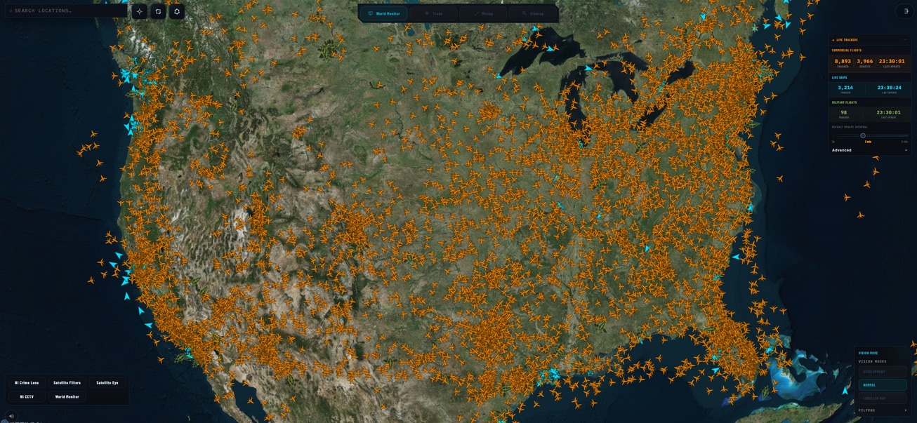

01 / Fuse the theatre Live Operating Picture
One map for civilian aircraft, vessels and military movement.
The live movement layer reduces the gap between separate tracking feeds. Commercial aircraft, maritime AIS, satellite maritime signals and military flight data can be viewed together to understand pressure around borders, ports, airspace and strategic corridors.
- Airspace monitoring and aircraft identification.
- AIS ship tracking across maritime zones.
- Military flight overlays and pattern review.
USA Operating Picture
Live fusion